The Sophisticated & Imposing
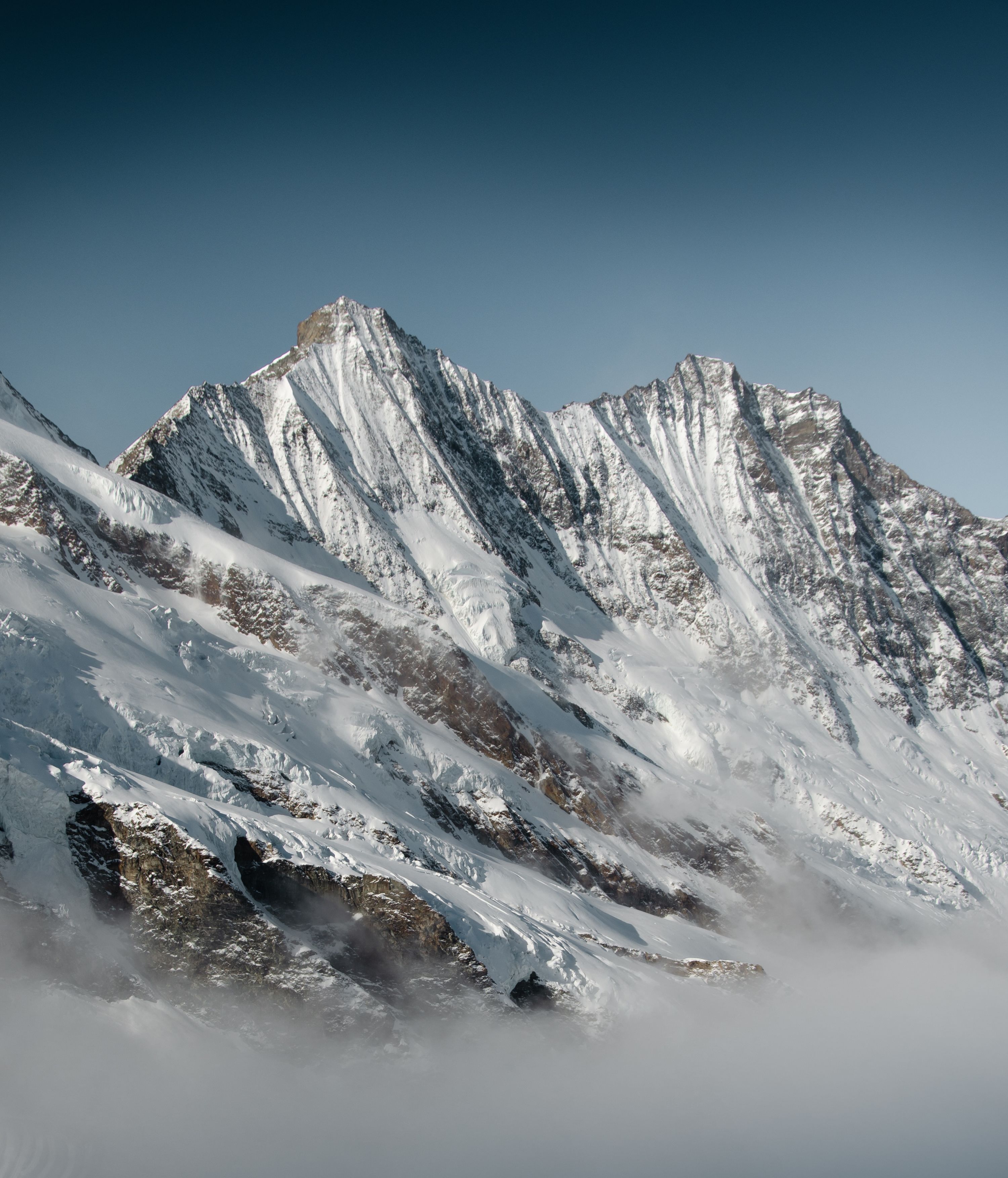
The "Primus inter pares", the most beautifully shaped peak of this group, fascinating the observer with its regular pyramid shape, closes the group in the south. The Täschhorn has three small, striking ridges and flanks, all of which are demanding to very difficult touring destinations. It is therefore not surprising that the Täschhorn is on the waiting list of many alpinists.
Key Facts:
→ First ascent: 31 July 1862 by Stefan Zumtaugwald. Johann Zumtaugwald, J.Llewelyn Davies, J.W. Hayward. and Peter-Josef Summermatter.
→ Altitude: 4,491 m asl
→ Routes:
From Mischabeljoch (SSE ridge, Mischabel ridge) | Difficulty: ZS
From Mischabeljoch via Täschhorn and Dom to Domhütte | Difficulty: S
WSW ridge, Teufelsgrat (from Täschhütte)
Mountain and SAC huts nearby
The Täschhütte is the starting point for some of the great four-thousanders of the Swiss Alps. The Täschhütte is situated at 2'701 m above sea level amidst the four-thousanders of the Mischabel group on the Rinderberg, at the foot of the Alphubel-Rotgrat and above the Täschalp and the valley community of Täsch. The hut is also ideal for ski touring and is open during the ski touring season.
The Mischabeljochbiwak, the second highest hut of the Swiss Alpine Club, is located at 3,855 m asl near Saas-Fee and offers 24 beds. It was completely renovated in 1995.
The Domhütte is a central starting point for climbing 7 four-thousanders and offers a dreamlike mountain scenery for mountaineers and hikers. It is located in a high alpine landscape and can be reached from Randa in about 4.5 hours via a high alpine approach. The trail leads first through a beautiful larch forest and then over rocks to the hut. Adventurous! The ascent over the rocks is always well secured with ropes, ice axes or ladders. Ibex, marmots and even snow grouse are not uncommon. Once you have reached 2,940 meters above sea level, you can enjoy a magnificent panorama from the hut, which was completely renovated in 2012.


